This Map Shows The Creepy Satellites Passing Above Your Home In Real Time
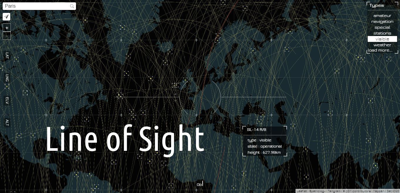
Short Bytes: Artist and engineer Patricio Gonzalez has used the available open resources and metadata to create a real-time interactive map for satellite watching. His creation, Line of Sight, is an amazing map that shows the satellites over your city in real-time.
But, these few minutes are enough to locate them if you know the right method and resources. Patricio Gonzalez is an artist and an engineer at the open-source mapping startup Mapzen. He has created Line of Sight, an amazing map that shown the satellites over your city in real-time.
You can head over to this link, enter your city’s name, and hover to see which satellites are over your city.
This map has been created using the available metadata from sources like SatNOGS. Gonzalez’s creation uses them to track the satellites and presents them right in front of you.
Satellite watching isn’t something new, but Gonzalez has made this very fascinating and easy with Line of Sight.
Did you enjoy viewing your city and the satellites above you in real-time? Tell us in the comments below.
Also read: This Amazing Map Shows 885,000 km Internet Cables Hidden Under the Ocean
[adinserter block=”12″][adinserter block=”13″]