Google “Land Lines” Game Turns Your Crappy Doodles Into Satellite Images
Short Bytes: Google Land Lines is a project which allows you to watch satellite images by creating gestures using your mouse pointer or fingers of your phone. The database currently has around 50,000 Google satellite images stored on Google Cloud Storage.
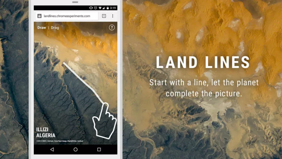
Google Earth is fascinating; it shows you the viewpoint of the satellites hanging above and continuously recording imagery of the ever revolving planet earth. Now, Google has taken the world exploration to a new level in the form of a simple game.Known as Land Lines, the game is a part of Chrome experiments which shows satellite images in response to the random lines drawn on the screen. There is another mode in which you have to drag your finger or mouse pointer, and different images will start popping up on your screen.
How do they do it?

The system compares the patterns you draw on the screen with a database of more than 50,000 images hosted on Google Cloud Storage. It displays the images which resemble your pattern. The images contain a variety, including open fields, streets, beaches, deserts, interchanges, etc.
The Land Lines project is created by Zach Liberman and Matt Felsen along with contributions from Google’s Data Art Team.
You can try Land Lines on Chrome Experiments using this link.
If you have something to add, tell us in the comments below.
Also Read: Mark Zuckerberg Unveils His Personal ‘Jarvis’ AI Assistant